Tabby Ruins Travel Guide
Barbara Stevenson
  • Home
  • List
  • Blog
  • Contact

McIntosh Sugar Mill Tabby Ruins

4/30/2015

4 Comments

 
McIntosh Sugar Mill Ruins (Photo by Barbara Stevenson)
Description

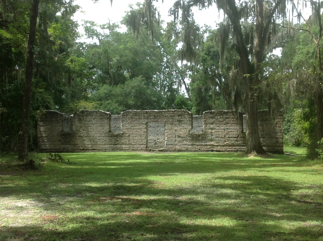
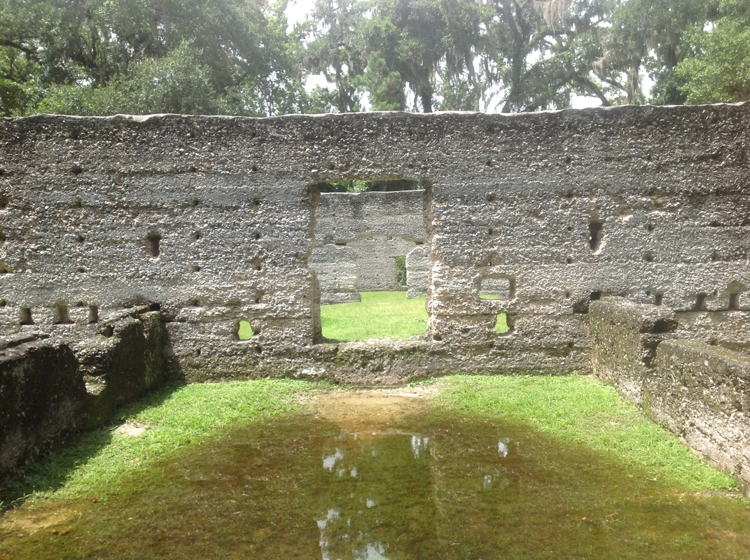
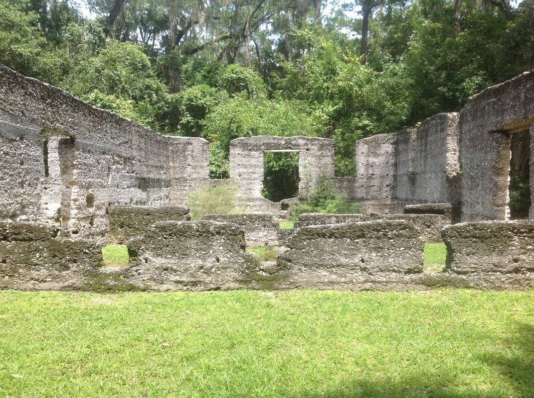
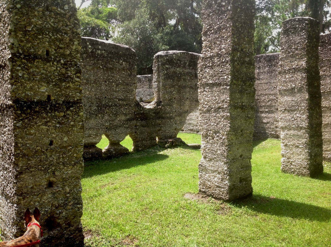
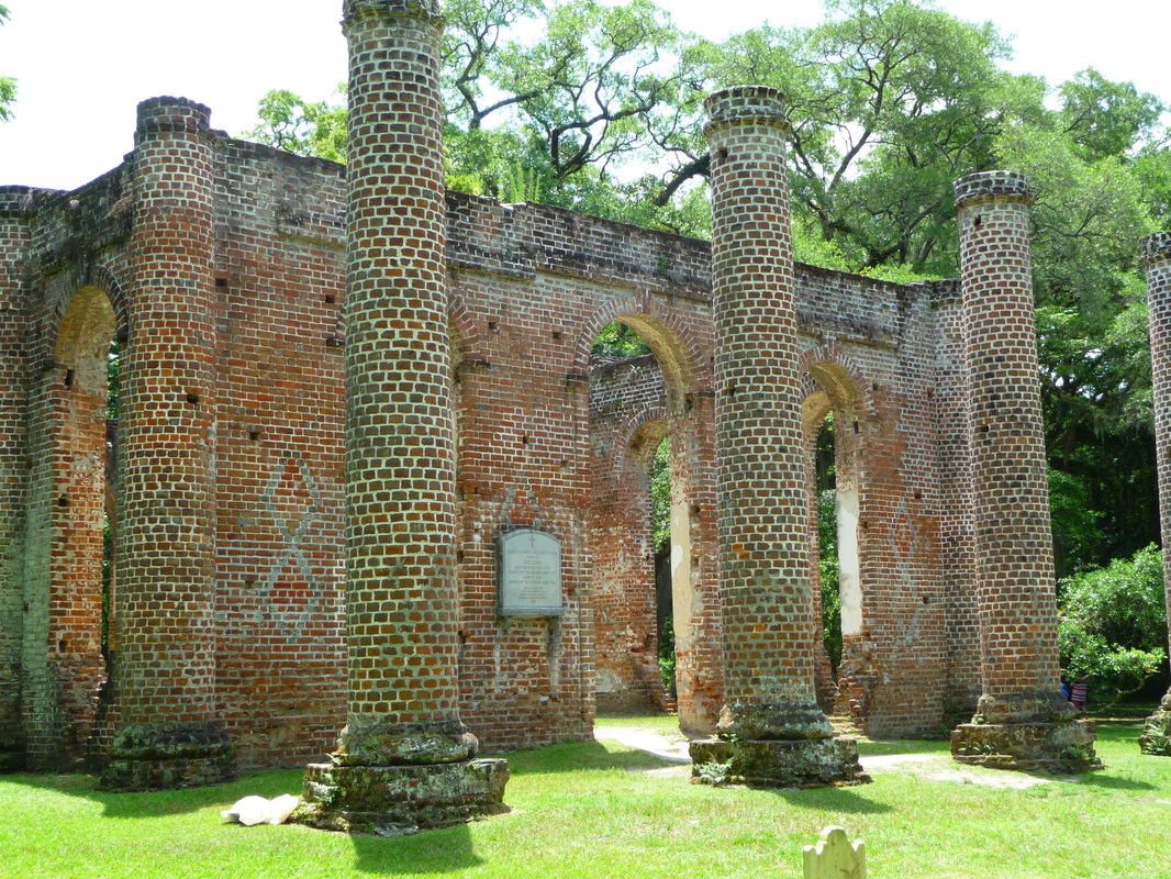
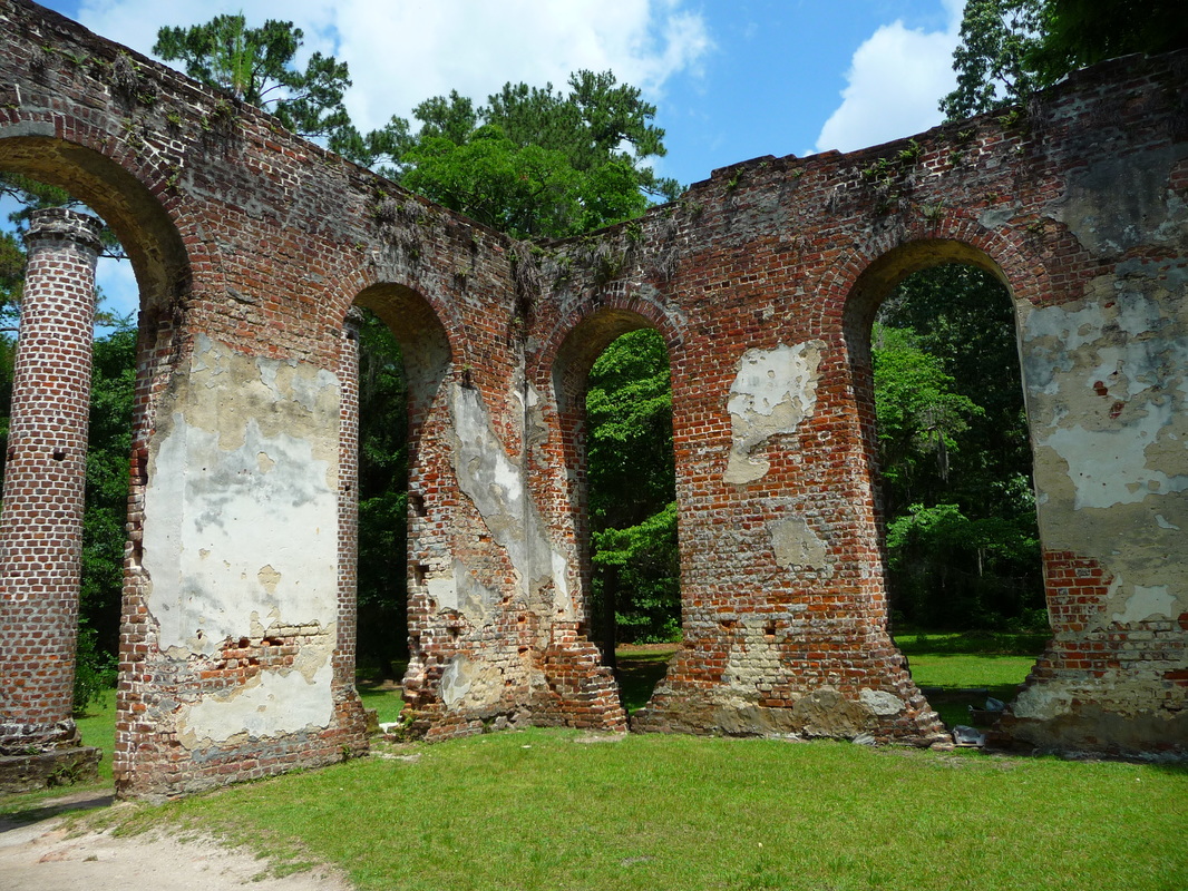
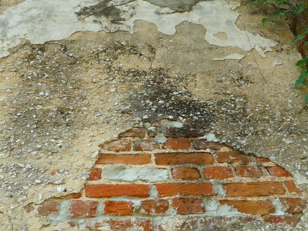
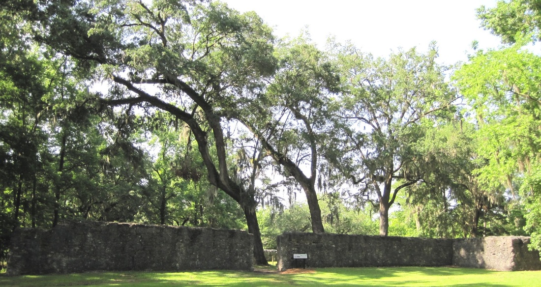
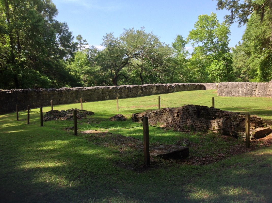
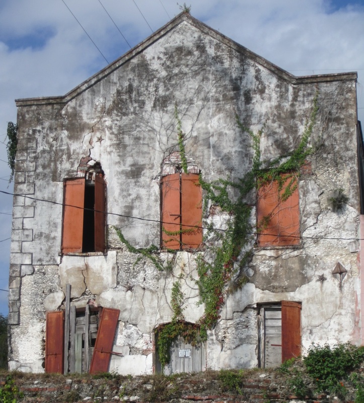
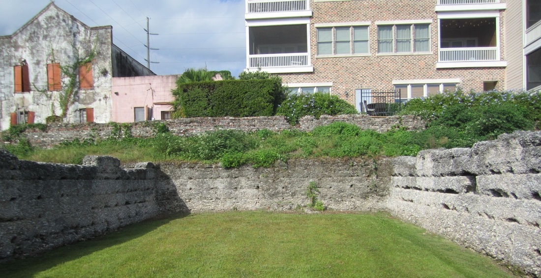
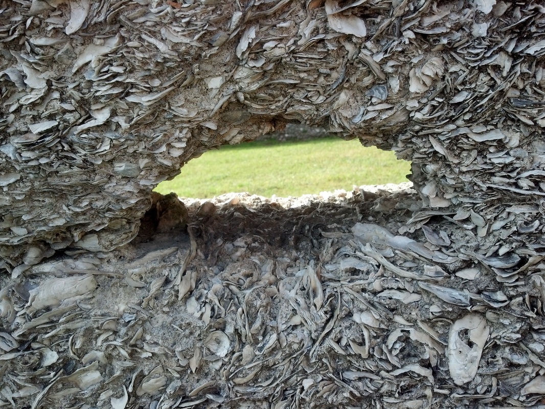
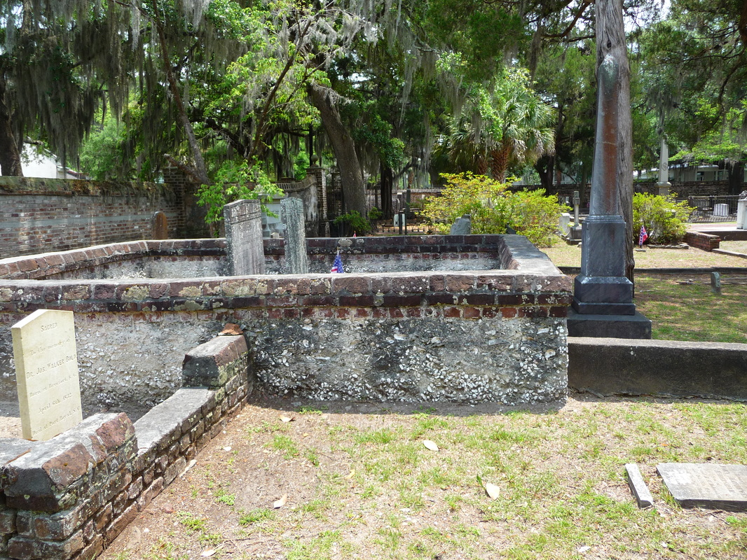
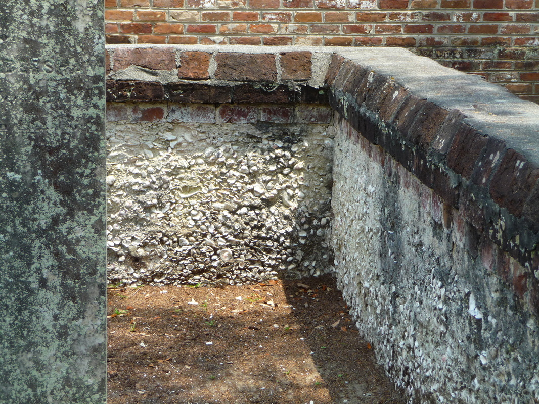
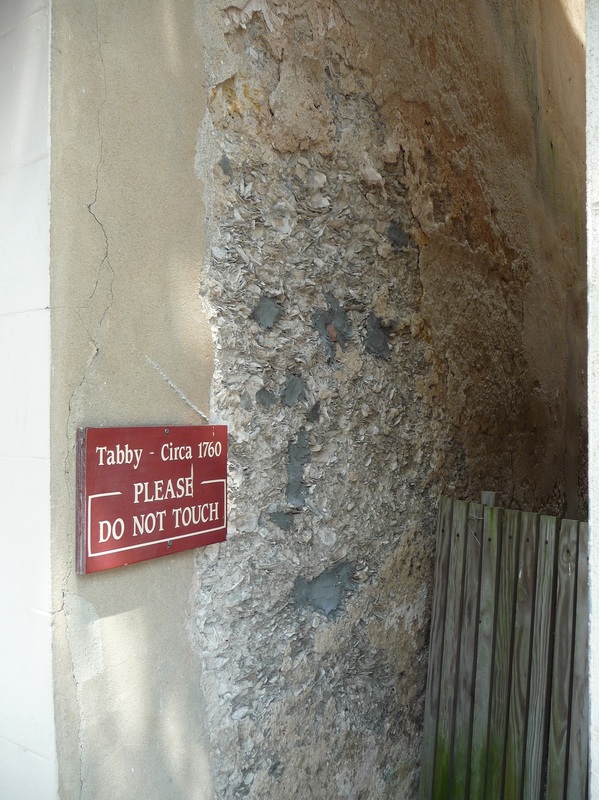
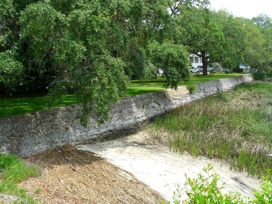
According to the Kingsland Convention and Visitors Bureau, the sugar mill “is the largest and best preserved of all tabby remains in the Southeast.”

History

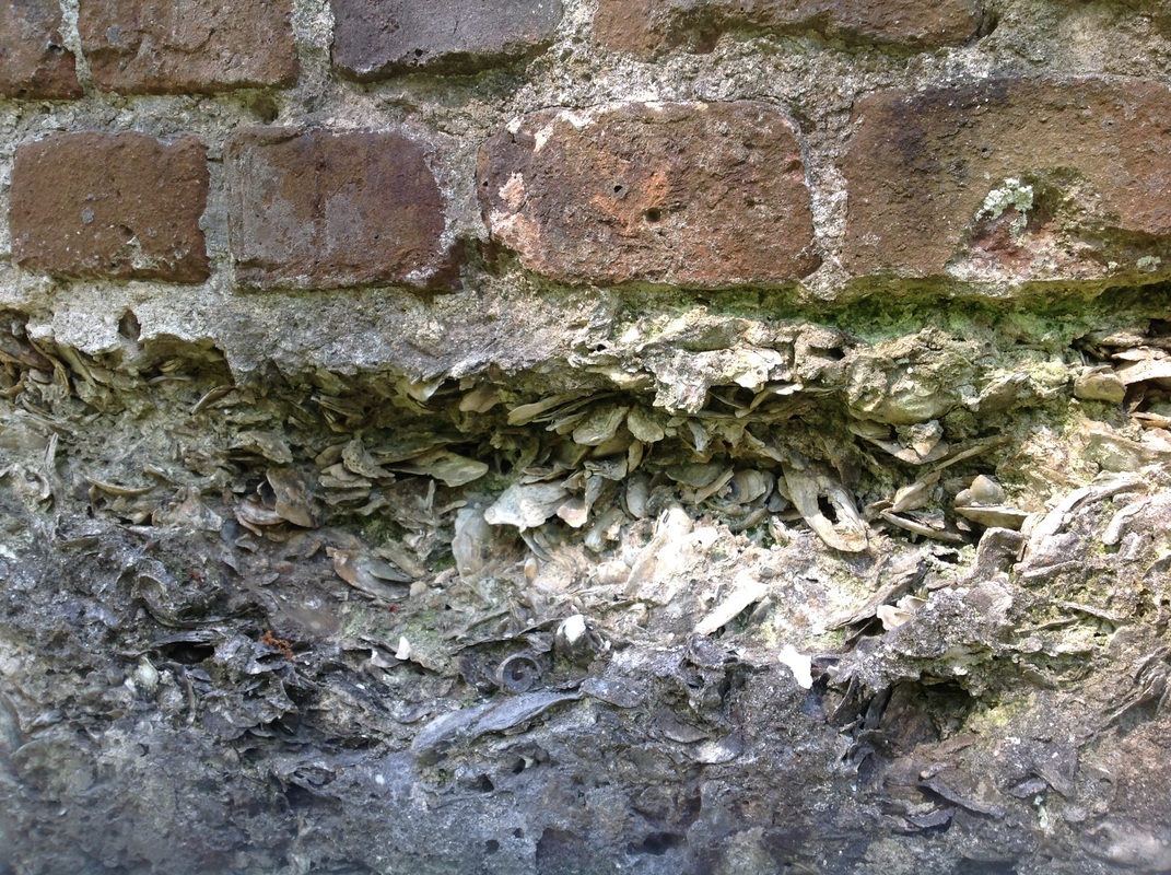
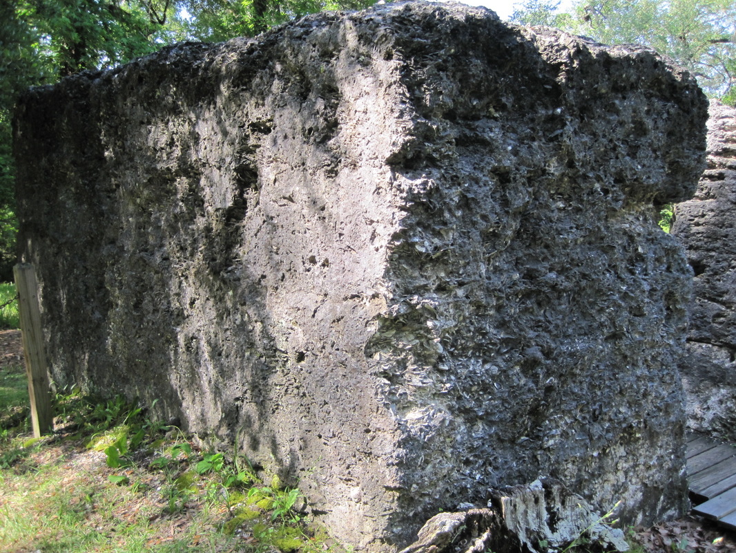
Built in 1826, this innovative sugar factory had dimensions of 120' x 75' and consisted of three rooms: one for boiling, for grinding, and for curing sugar. John Houstoun McIntosh (1773-1836) constructed the mill on the site of his New Canaan Plantation, where he grew sugar cane. New Canaan was sold after McIntosh’s death, and the mill burned in the mid-1800s and was not rebuilt.

Location
 
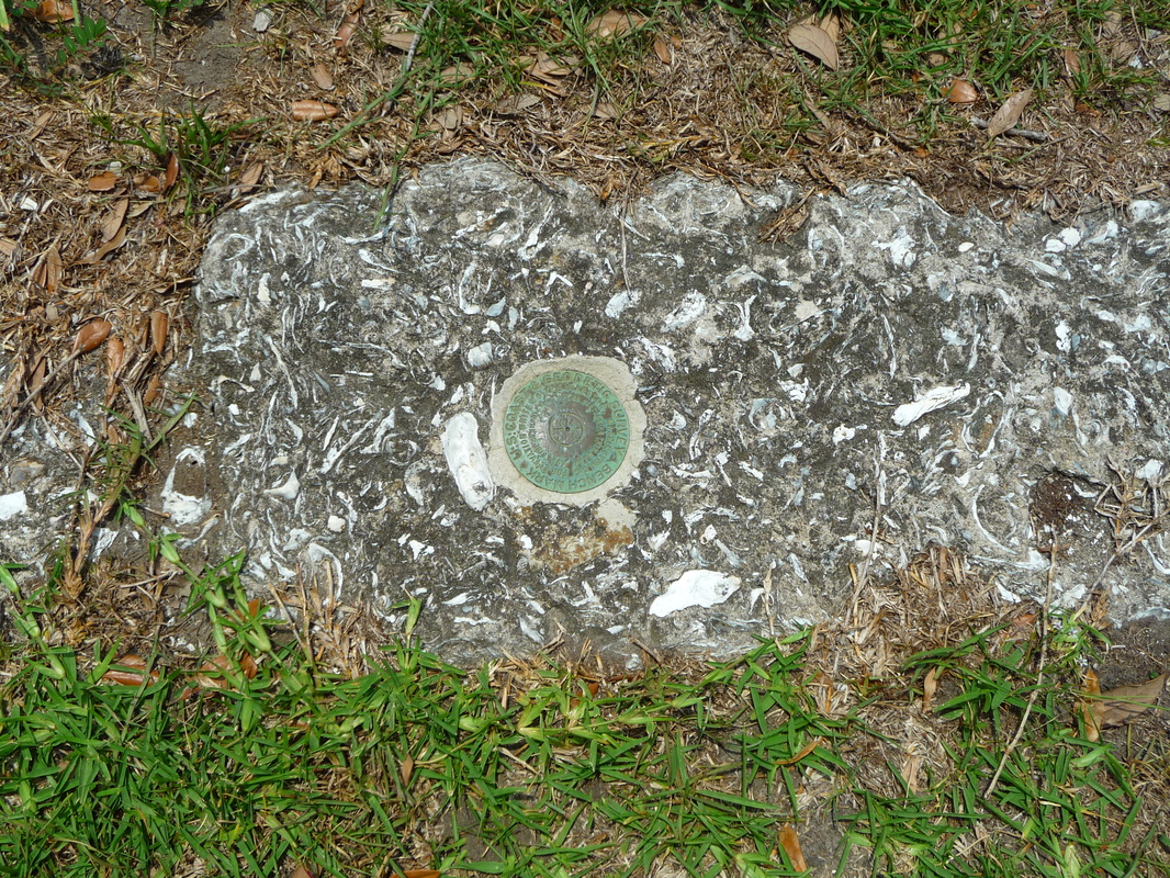
GPS: N 30°47.595 and W 81°34.738

Address: Charlie Smith Sr. Hwy (GA Spur 40), St. Marys, GA 31588. On the side of the road, just left of Kings Bay Road and the Stimson Gate of Naval Submarine Base Kings Bay.

Accessibility: It features a parking lot and a picnic area. Open year round from sunrise to sunset.

For more information, see Brown’s Guide to Georgia and Kingsland Convention and Visitors Bureau.

4 Comments

Old Sheldon Church Ruins

4/27/2015

0 Comments

 
Old Sheldon Church (Photo by Cheryl Warren)
Old Sheldon Church Tabby (Photo by Cheryl Warren)
Description

Old Sheldon Church ruins feature majestic brick columns, but tabby is minimal. Tabby can be detected as a mortar and as sparsely remaining stucco. A graveyard is adjacent to the church. The scenic spot is popular for weddings and is under the auspices of the Parish Church of St. Helena.

History

According to signs at the site, Old Sheldon Church--originally named Prince William's Parish Church--was erected in 1751 and was burned by Loyalists in 1779. It was rebuilt in 1825, but freedmen dismantled it shortly after the Civil War.

Location

GPS: N 32°37.113 and W 80°46.837

Address: Old Sheldon Church Road, Yemassee, SC 29945

Accessibility: Located about 17 miles north of Beaufort, on Old Sheldon Church Road between
Highways 17 and 21. A parking lot is across the road from the ruins.

0 Comments

Fort Dorchester

4/22/2015

1 Comment

 
Dorchester (Photo by Barbara Stevenson)
Dorchester (Photo by Bill Hill)
Dorcheser (Photo by Bill Hill)
Dorchester (Photo by Barbara Stevenson)
Description

Much remains of Fort Dorchester's tabby-and-brick powder magazine. Constructed in 1757, the massive magazine walls measured 8’ high x 2' thick and spread over 100 square feet. In addition to the magazine, the Colonial Dorchester State Historic Site includes a brick bell tower and a cemetery.

History

The fortified town of Dorchester was established in 1695, and the magazine was built in 1757. During the Revolutionary War, the famous heroes Francis Marion and Nathanael Greene were at Dorchester. The town was abandoned in 1788. 

The site was placed on the National Register of Historic Places on December 2, 1969.

Location

GPS: N 32°56.829 and W 80°10.212

Address: Colonial Dorchester State Historic Site, 300 State Park Road, Summerville, SC 29485

Accessibility: Located near Charleston, off Interstate 26, the park charges $2 for
admission, is open 9am-5pm daily, and has a parking lot near the fort.

For more information on the state park, see http://www.southcarolinaparks.com/colonialdorchester/introduction.aspx.
For more historical information on Dorchester. see Daniel J. Bell's Old Dorchester State Park: Visitor’s Guide. 
1 Comment

Darien Tabby Walls and Adam-Strain Building

4/18/2015

3 Comments

 
Darien Tabby Walls and the Adam-Strain Building (Photo by Barbara Stevenson)
Adam-Strain Building (Photo by Bill Hill)
Darien Walls (Photo by Bill Hill)
Darien Tabby Walls (Photo by Barbara Stevenson)
Description


The tabby walls in Darien, GA are the remnants of the town’s cotton exchange warehouses and naval stores built 1815-1830. The Adam-Strain Building, built circa 1813, was a mercantile store and ship chandlery. 

History

These tabby ruins attest to Darien's importance as a port for the export of cotton and timber in the early 1800s.  The Union Army burned these structures in 1863. The Adam-Strain building was restored in 1873. The Georgia Trust for Historic Preservation designated it as one of the 2008 Places in Peril after its owner attempted to demolish it; its future remains uncertain.

Location        

GPS: N31°22.113 W81°26.167 

Address: The Adam-Strain Building sits at 109 Broad St., Darien, GA 31305. The tabby walls are directly behind the building, facing the waterfront.

Accessibility: The Adam-Strain Building is privately owned and not open to the public. A free public parking lot is close to the building and tabby walls at Skipper's Fish Camp at 85 Screven Street, Darien GA 31305.

For more information, see the article on the Adam-Strain Building at Explore Georgia.
3 Comments

Beaufort--The Tabby City

4/16/2015

0 Comments

 
PictureThe Arsenal (Photo by Bill Hill)
The coastal town of Beaufort, located roughly halfway between Savannah and Charleston, was the center for British tabby, starting around 1700. Today, Beaufort County has the highest concentration of tabby in the United States. (For more information on Beaufort tabby, see Daniel Adams’ article, “Tabby: The Oyster Shell Concrete of the Lowcountry,” Beaufort County Library.) 

Because Beaufort has maintained many edifices, the tabby is covered with stucco or other material, and the buildings are occupied. Therefore, most of Beaufort’s tabby structures are beyond the scope of this blog about abandoned ruins of exposed oyster shell concrete. However, glimpses of tabby can be seen at sites listed below:

The Arsenal

The Arsenal is the one tabby building in this list where the oyster shell concrete is not visible. However, it is included because it is the Visitor Center and a good place for information. Originally made of brick and tabby in 1795, the Arsenal was rebuilt in 1852 and renovated in 1934.


Location

GPS: N 32°25.959 and W 80°40.234

Address: 713 Craven St., Beaufort, SC 29902

Accessibility: Open Monday-Saturday 9am-5pm and Sunday 12pm-5pm. For more information, go to http://www.beaufortsc.org/.

St. Helena's Episcopal Church

The church and cemetery are surrounded by tabby walls. The church was constructed in 1724 and expanded in 1842.

St Helena's Church Yard (Photo by Cheryl Warren)
St. Helena's Church Yard (Photo by Cheryl Warren)
Location

GPS: N 32°26.054 and W 80°40.455

Address:  505 Church Street

Accessibility: The tabby walls are outside in the church yard and can be seen any time, but to tour the church and attend services, see the church website at http://www.sthelenas1712.org/.

Bay Street Building Exterior


A sign indicates that this Bay Street building was constructed circa 1760.


Picture
Bay Street Building Exterior (Photo by Cheryl Warren)
Location

GPS: N 32°25.851 and W 80°40.240

Address:  715 Bay Street. Look at the side of the building extending into a narrow alley. 

Accessibility: Bay Street is Beaufort's key location for shops, restaurants, etc. Park in one of the Bay Street lots and walk to this and the next two sites.

Verdier House

Constructed circa 1804, this Federal-Style mansion is now a museum. Although it costs $10 to tour the house, the ground floor is free and open to the public. The ground floor displays a sliver of tabby, forming the base of the walls, along with other historical artifacts. 
Verdier House (Photo from Historic Beaufort Foundation)
Verdier Basement Wall (Photo by Cheryl Warren)
Location

GPS: N 32°25.845 and W 80°40.256

Address:  801 Bay St.

Accessibility:  Open Monday-Saturday 10am-4pm. Although it costs $10 to tour the house, the ground floor (with tabby sample and other artifacts) is free and open to the public. For more information, see the Historic Beaufort Foundation website at https://www.historicbeaufort.org/verdier-house.php. 

Tabby Sea Wall

The sea wall is of undetermined date and origin.
Beaufort Sea Wall (Photo by Cheryl Warren)
Location

GPS: N 32°25.837 and W 80°40.172

Address: Located at the east end of Bay Street between Carteret and New Streets, at the Stephen Elliott Park.

0 Comments
<<Previous

    Archives

    October 2017
    August 2017
    December 2016
    September 2016
    August 2016
    July 2016
    May 2016
    April 2016
    March 2016
    February 2016
    January 2016
    December 2015
    November 2015
    October 2015
    September 2015
    June 2015
    May 2015
    April 2015

    ©Barbara Stevenson
    

    This  site is the property of Barbara Stevenson. Unless otherwise noted, any borrowed content must give credit to:
     www.tabbyruins.com.

    RSS Feed

    Categories

    All
    Florida
    Georgia
    South Carolina

Powered by Create your own unique website with customizable templates.