Tabby Ruins Travel Guide
Barbara Stevenson
  • Home
  • List
  • Blog
  • Contact

Tabby Horn Work Remnant

10/23/2017

2 Comments

 
Description

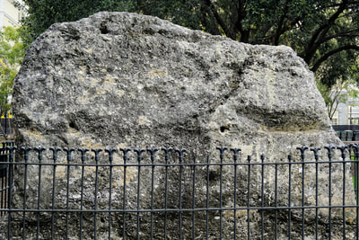
A lone tabby slab stands in Charleston’s busy Marion Square, a small remnant of what was once a massive fortification. It is surrounded by a fence with a plaque that reads, “Remnant of Horn Work. May 1780. Siege of Charleston.”

History

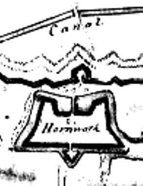
In 1757 construction began on a large earth and tabby horn work, which is a fortified wall with two half-bastions (the “horns”). It served as town gate near today’s King Street and included a gate and drawbridge. Fortifications were deemed necessary to protect Charleston against the Spanish. However, as the conflict with Spain came to an end—as did the subsequent war with England, the city decided it no longer needed the fortifications. The horn work was destroyed in 1784. (The map and information on the horn work comes from Nic Butler’s blog, the Mayor’s Walled City Task Force.)

Location

GPS: N 32°47.206 and W 79°56.181

Address: Marion Square (by the side of King Street across from the Marion Francis Hotel), Charleston SC 29403
​
Accessibility: always open to the public

2 Comments

Tabby Silo

8/6/2017

0 Comments

 
Description

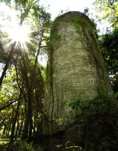
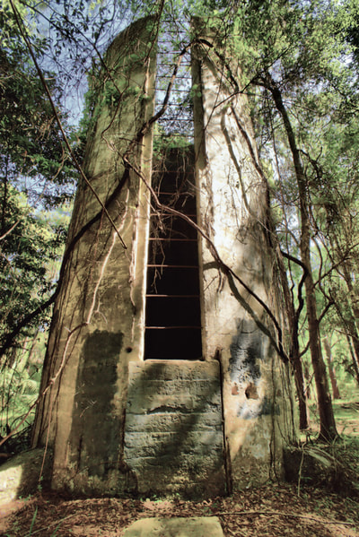
An abandoned tabby silo hides among the trees on Jekyll Island, GA.

History

From 1886 to 1947, Jekyll Island was the winter vacation home of the world's wealthiest elite, including J. P. Morgan, Joseph Pulitzer, and the Rockefellers. A silo made from revival tabby (oyster shells mixed into Portland cement) was constructed about 1910 as part of a dairy farm. Today it is the only structure from the Jekyll Island Club Era not found in the National Historic Landmark District.

Although it lacks the historical significance of the island's Horton tabby site and the architectural interest of Hollybourne Cottage, it appeals to those who like to explore off the beaten path. It is located in the woods off an unpaved portion of Old Plantation Road between Jennings Avenue and the Methodist Church.

Location

GPS: N 31°04.699 and W 81°25.424

Address: It sits in the woods off an unpaved portion of Old Plantation Road between Jennings Avenue and the Methodist Church. An unmarked, unpaved trail to the tower can be seen from North Riverview Drive. 

Accessibility: It can only be reached by foot or by bike. It is a short walk from where the pavement ends on Old Plantation Road past the intersection with Jennings Avenue.


0 Comments

St. Cyprian's Church

12/6/2016

0 Comments

 
Description

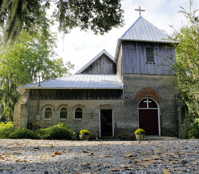
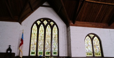
Although St. Cyprian’s is an active church and not an abandoned ruin, visitors to Darien,GA can view the exterior walls made of exposed tabby. When I went to the Episcopal church, the Very Reverend Ted Clarkson kindly invited me in and explained the church’s history. 

History

Freed slaves built the picturesque church in 1875, using techniques of tabby construction from Antebellum times. There is debate over whether Portland cement or tabby concrete (made from burning oyster shells) was used, and no test has yet been done to determine the answer. Although the exterior tabby is exposed, the interior walls are covered with stucco, which has typically been the case for tabby structures.

The church sits on land donated by Frances Kemble Butler Leigh, the daughter of famous abolitionist and actress, Fanny Kemble, and of local planter, Pierce Butler. Mrs. Leigh’s husband, James Wentworth Leigh, was the Anglican Dean who first ministered to the freed slaves who built St. Cyprian’s. (For more information, visit http://standrewsstcyprians.georgiaepiscopal.org/) 

Location

GPS: N 31°22.014 and W 81°25.921

Address: 401 Fort King George Dr., Darien GA 31305

Accessibility: The outside of the tabby church can be seen any time, but entrance to the church is limited to services.
0 Comments

Sister's Creek Tabby House Walls

9/22/2016

6 Comments

 
Description

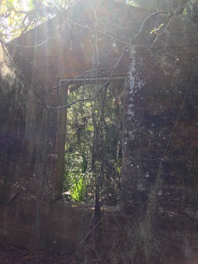
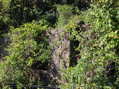
This entry on the recent discovery of tabby house walls at Sister’s Creek in Jacksonville FL is courtesy of J. Scott Barnard, a graduate student at the University of North Florida. Scott reports the house was uncovered while the woods were being cleared for construction of the new Sister’s Creek bridge on Heckscher Drive. The house’s walls are still standing, but a brick fireplace has been removed. Its history is unknown, but Scott thinks it might have been a one-room slave cabin dating from the 19th century.

It is on protected archaeological land near shell middens. Extensive middens in the area provided the oyster shells for this house, the Kingsley Plantation slave cabins, the Thomson House, and the Fitzpatrick Plantation walls—tabby sites all located within a 20-mile radius of each other in the vicinity of the Timucuan Preserve.

Location

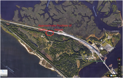
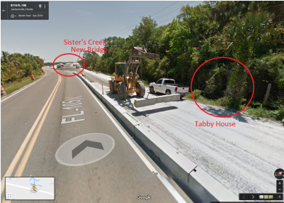
Visitors headed to Kingsley Plantation can catch a glimpse of the tabby walls in the woods off to the side of Heckscher Drive in Jacksonville FL. The site is west of the new Sister’s Creek bridge on the south side of Heckscher. There is no parking lot, and no information is available on the stability of the walls.
​
Scott has kindly provided the following images to indicate location:

Picture
Picture
6 Comments

Ashantilly

8/7/2016

0 Comments

 
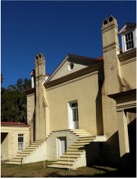
PictureAshantilly (Photo by Barbara Stevenson)
​
Description
 
Ashantilly was the mainland home of Thomas Spalding, who revived the use of tabby in the early 1800s. Today the restored home is a non-profit educational center located close to Darien GA.
 
History
 
Thomas Spalding (1774-1851) built this tabby home in 1820 and named it “Ashantilly” after his family’s ancestral home in County Perth, Scotland.  Spalding was a Georgia legislator and planter, who owned Sapelo Island. He was also a well-known agriculturalist who developed procedures of crop rotation & diversification and who revived the use of tabby (​New Georgia Encyclopedia).Tabby was previously used for fortifications, but Spalding expanded its use for plantations, mills, and other agricultural buildings.
 
After the house burned in 1937, Ashantilly owner and printer William G. Haynes, Jr., rebuilt the home upon the tabby foundations that survived the fire (the oyster shell concrete foundations cannot be seen).   Haynes founded the Ashantilly Press and Ashantilly Center.  Today the center hosts cultural events and workshops (see ashantilly.org).
 
Location
 
GPS: N 31°22.877 and W 81°24.844
 
Address: From Darien, turn on Highway 99 going east toward the coast. After about 1.5 miles, turn right onto either St. Andrews Cemetery Rd. or Ashantilly Rd. to get to the Center.
 
Accessibility: Ashantilly is open for events. For more information, visit ashantilly.org.

0 Comments
<<Previous

    Archives

    October 2017
    August 2017
    December 2016
    September 2016
    August 2016
    July 2016
    May 2016
    April 2016
    March 2016
    February 2016
    January 2016
    December 2015
    November 2015
    October 2015
    September 2015
    June 2015
    May 2015
    April 2015

    ©Barbara Stevenson
    

    This  site is the property of Barbara Stevenson. Unless otherwise noted, any borrowed content must give credit to:
     www.tabbyruins.com.

    RSS Feed

    Categories

    All
    Florida
    Georgia
    South Carolina

Powered by Create your own unique website with customizable templates.