Tabby Ruins Travel Guide
Barbara Stevenson
  • Home
  • List
  • Blog
  • Contact

Fish Haul Plantation 

4/9/2015

0 Comments


Description

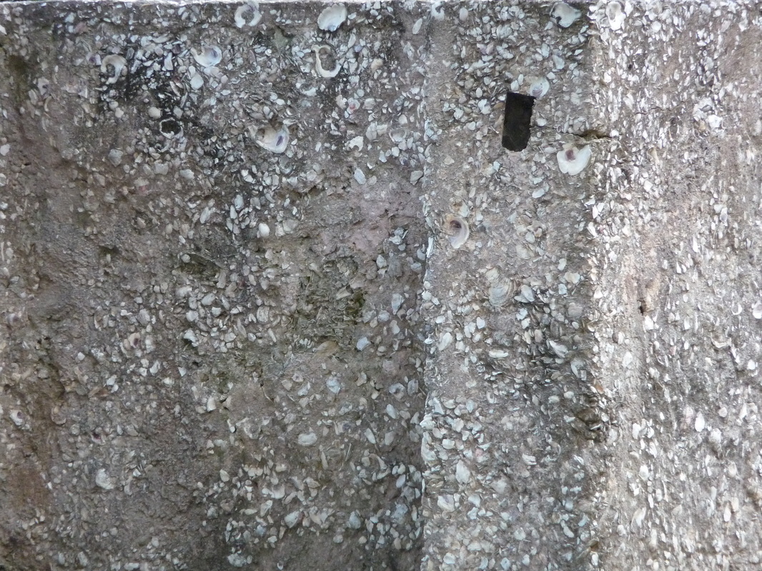
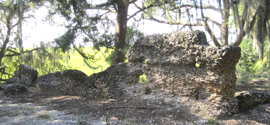
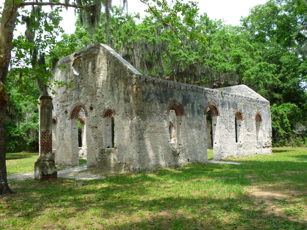
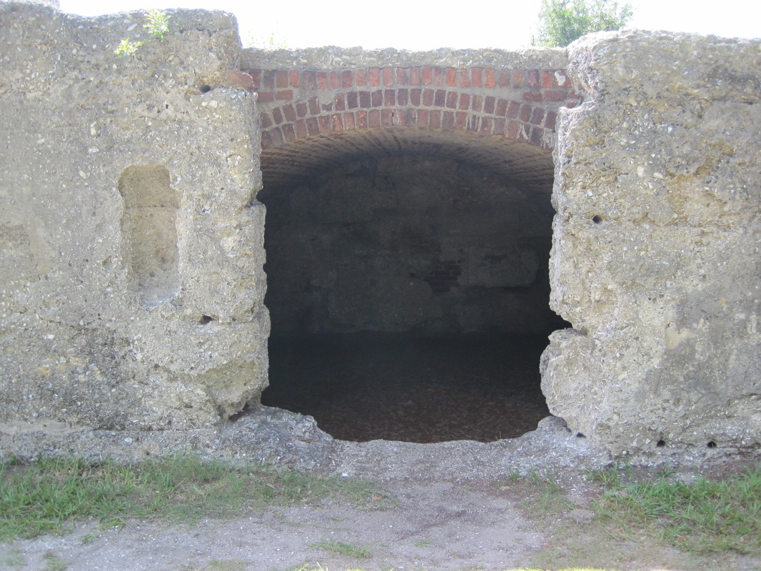
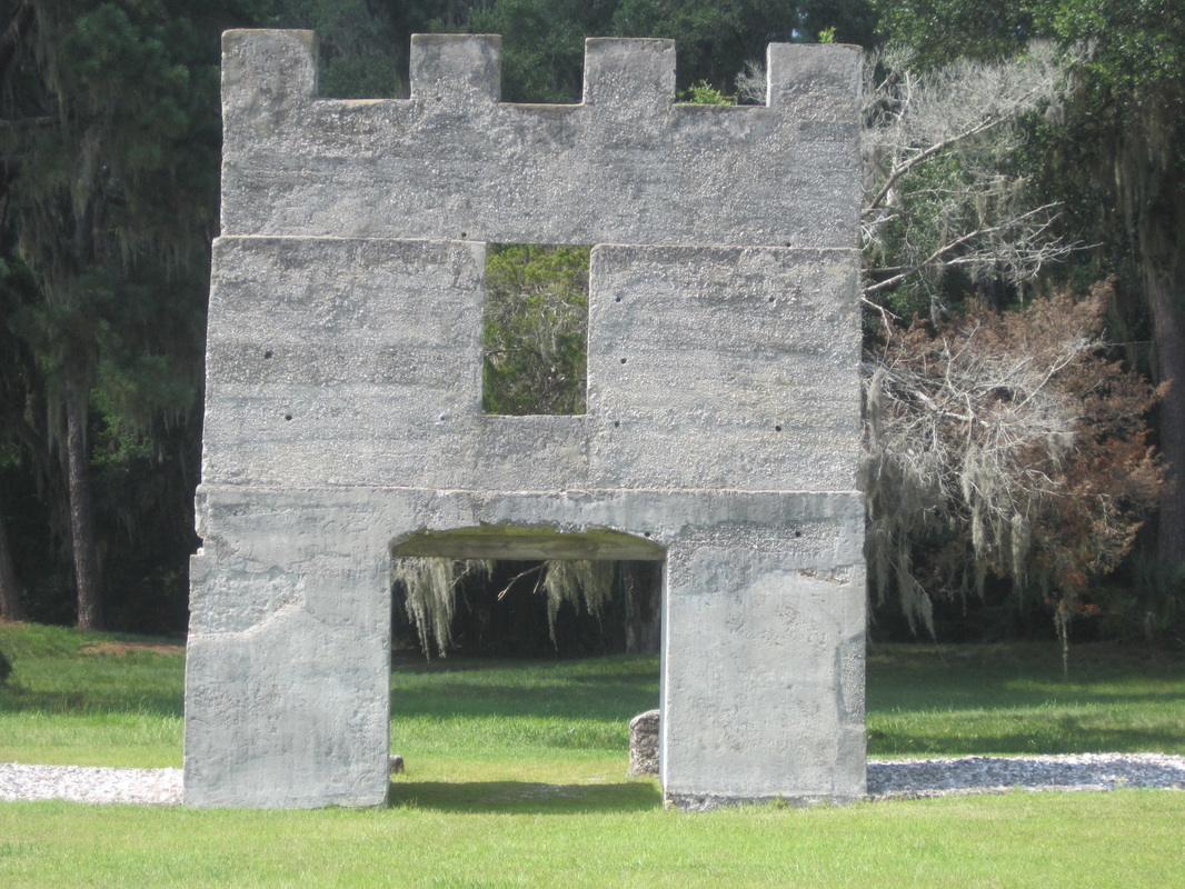
A fence encloses three standing tabby chimneys of slave cabins, with additional tabby rubble on the ground. In the woods next to the fence is another tabby remnant. According to the Heritage Library Foundation, “The tabby used is a distinct mix containing whole clam shell in addition to the normal oyster shell aggregate.   Broken brick, glass and ceramics are also spotted in the tabby.” 

History

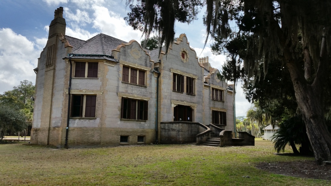
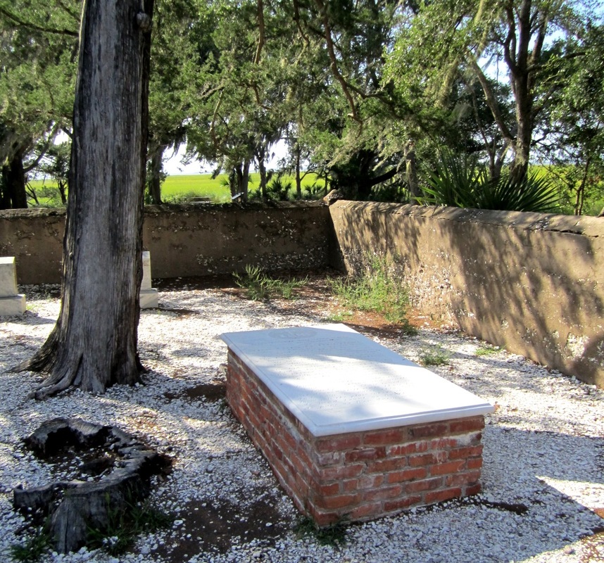
Established in 1762, Fish Haul Plantation gets it name from the adjoining Fish Haul Creek. It also goes by the name Drayton Plantation from owner Thomas Fenwick Drayton, a Confederate general who used his family home as his headquarters in 1861. Union forces captured the property, giving a portion of it to former slaves. The freed slaves who received some of the property formed Mitchelville, the nation’s first freedmen’s village.

Location

GPS:  N 32°18.291and W 80°38.555

Address: 70 Baygall Rd., Hilton Head Island, SC 29928

Accessibility: The ruins are enclosed in a fence next to Barker Field; another tabby remnant
is situated in adjacent woods.

For more information see the Heritage Library Foundation.

0 Comments

Hollybourne Cottage

4/8/2015

0 Comments

 
Picture
Hollybourne Cottage (Photo by Barbara Stevenson)
Description

Located in Jekyll Island's Historic District, Hollybourne Cottage is an example of Revival Tabby. Revival Tabby is a late nineteenth-century style of imitation tabby using Portland cement.

History

The du Bignon family, who owned Jekyll Island and operated a slave plantation, sold the island after the Civil War to the Jekyll Island Club. Formed in 1886, the club included the world's wealthiest elite--J. P. Morgan, Joseph Pulitzer, the Rockefellers, etc. Club members vacationed on Jekyll during the winter, and some built vacation homes. Charles Stewart Maurice built Hollybourne Cottage in 1890. The Great Depression and World War II ended the exclusive Jekyll Island Club, and the State of Georgia purchased the island in 1947. Hollybourne Cottage is the last of Jekyll's historic homes to be restored.

Location

GPS: N 31°03.733 and W 81°25.383

Address: 379 Riverview Drive, Jekyll Island GA 31527, in the Historic District..

Accessibility: There is a toll (currently $6) to cross the Musgrove Downing Causeway to enter the island, but it is free to park and to walk through the Historic District. Be sure to head north, not south, on Riverview Drive. Riverview Drive turns into a pedestrian walkway in the Historic District at the Jekyll Island Club Hotel. There is a parking lot across from the hotel at the marina. Hollybourne is on the pedestrian walkway. Hollybourne's exterior can be viewed, but the interior is closed because of ongoing renovations.

For more information, see the website of the Jekyll Island Authority, which operates the island for the State of Georgia.
0 Comments

Horton House Historic Site

4/6/2015

0 Comments

 
Description 

Jekyll Island's Horton House Historic Site contains the State of Georgia's oldest tabby ruins and consists of three tabby structures:

1. The Horton House is the remnant of a two-story tabby home covered by stucco with two rooms on the remaining ground floor, one of which has a fireplace. 

2. The du Bignon family cemetery is directly across the street from the Horton House. A covered tabby wall with a wrought iron gate encloses the graves of Amelia du Bignon, Joseph du Bignon, Marie Felicite Riffault, Hector de Liyannis, and George Harvey. 

3. A tabby warehouse, well, and brewery ruins lie adjacent to the cemetery. The tabby is exposed (not covered with stucco).

History

The Horton House was constructed by Major William Horton, who served with Georgia founder James Oglethorpe. Horton was granted Jekyll Island in 1735 and began constructing the home after his arrival in 1736. After the Spanish burned his house, he rebuilt it in 1743. Horton also began construction of the warehouse and brewery. Horton died in 1748, and in the 1790s the Frenchman Poulain du Bignon purchased Jekyll and restored the house for his family. The du Bignons owned the island until 1886, at which point they sold it to the millionaires of the Jekyll Island Club, and the Horton site was abandoned.

Location

GPS: N 31°06.129 and W 81°24.87

Address: Riverview Drive, Jekyll Island GA 31527, on the north side of the island facing the marsh. There is no street number assigned to the Horton site. Drive north past the Historic District, airport, churches, and houses to the sign for the Horton House Historic Site.

Accessibility: There is a toll (currently $6) to cross the Musgrove Downing Causeway to enter the island, but the ruins are free and there is a parking lot at the site.

For more information, see the website of the Jekyll Island Authority, which operates the island for the State of Georgia.

0 Comments

Chapel of Ease

4/5/2015

0 Comments


Description

The church walls of the Chapel of Ease remain intact, and a small cemetery is close by. It is a rare example of a tabby church ruin--Old Sheldon Church is more brick than tabby, while other tabby churches (such as ones in Darien, GA) are functioning churches, not ruins.

History

Constructed about 1740, it was a "chapel of ease" for planters in the vicinity of St. Helena Island who lived too far from the Anglican (now Episcopal) parish church in Beaufort, SC. In 1812 it became a parish church but was abandoned during the Civil War. Methodist freedmen used the church after the Civil War until it was destroyed by fire in 1886.

It was placed on the National Register of Historic Places on October 6, 1988.

Location         

GPS: N 32° 22.543 and W 80°34.604

Address: 17 Land’s End Road, St. Helena Island, SC 29920

Accessibility: Enter the island on Sea Island Parkway  (U.S. Highway 21); turn right 
onto Martin Luther King Drive; go 1.5 miles, staying on the road as it turns into
Land’s End Road; the ruins will be on the left with an area to pull over in front
 of the church.

For more information, see South Carolina Department of Archives.

0 Comments

Fort Frederica

4/4/2015

0 Comments


Description

When the British built Frederica, tabby was used in the construction of the fort town, including the surviving remnants of the magazine, soldier barracks, house foundations, and walls.  Now a national monument, the expansive 40-acre site includes a visitor center.

History

James Oglethorpe established Fort Frederica on St. Simons Island in 1736 to protect the Georgia colony from the Spanish to the south. The fort was Oglethorpe’s source of defense in the 1742 Battle of Bloody Marsh, in which the British defeated the invading Spanish. Afterwards, the Spanish never again warred with the British in the New World, leaving Britain to be the major colonial power in what would become the United States. Fort Frederica went in decline after 1748 when England and Spain signed a peace treaty, and the town was abandoned after a fire in 1758.

Location

GPS: N 31°13.380 and W 81°23.338 (Fort Frederica National Monument parking lot)

Address: 6515 Frederica Rd., St. Simons Island, GA 31522

Accessibility: Open daily 9am-5pm, except on holidays; Admission is free.

For more information see the National Park Service's website on Fort Frederica National Monument and the New Georgia Encyclopedia entry on Fort Frederica.

0 Comments
<<Previous
Forward>>

    Archives

    October 2017
    August 2017
    December 2016
    September 2016
    August 2016
    July 2016
    May 2016
    April 2016
    March 2016
    February 2016
    January 2016
    December 2015
    November 2015
    October 2015
    September 2015
    June 2015
    May 2015
    April 2015

    ©Barbara Stevenson
    

    This  site is the property of Barbara Stevenson. Unless otherwise noted, any borrowed content must give credit to:
     www.tabbyruins.com.

    RSS Feed

    Categories

    All
    Florida
    Georgia
    South Carolina

Powered by Create your own unique website with customizable templates.